- This topic is empty.
-
AuthorPosts
-
2026-09-23 at 3:43 pm #14808
Groundwater exploration can be difficult when survey interpretation does not translate into a productive well, when drilling encounters dry or low-yield formations, or when field data leaves uncertainty about subsurface conditions. These outcomes can affect project budgets, schedules, and water-supply planning.
Rather than assuming that a site contains a viable aquifer—or that equipment alone can guarantee a successful well—the appropriate response is to reassess the hydrogeological model, survey design, data quality, and verification plan. Geomative Co., Ltd. provides electrical resistivity equipment and related digital tools that can support this process as part of an integrated groundwater investigation workflow.
Common Causes of Groundwater Exploration Failure
Before selecting a new survey approach, teams should identify why the original investigation did not produce a reliable drilling target.
Limited Spatial Coverage From Boreholes
Drilling, sampling, and pumping tests remain essential for confirming groundwater conditions, but individual boreholes provide point-specific information. If drilling locations are selected with limited understanding of lateral geological variation, fractured zones, or changes in formation properties, the likelihood of unproductive wells can increase.
Electrical resistivity surveys can add continuous profile information between investigation points. However, they should complement—not replace—boreholes, hydrogeological analysis, water-quality testing, and pumping tests.
Field Efficiency and Data Interpretation Challenges
Single-channel surveys can require more time for large-area coverage. Complex terrain, poor electrode contact, cultural interference, heterogeneous geology, and unsuitable survey layouts can also affect data quality and interpretation.
These limitations do not automatically mean that an aquifer has been missed. They indicate that the survey design, data-control process, geological model, and verification strategy may need to be reviewed before further drilling decisions are made.
Complex Geological and Hydrogeological Conditions
A low-resistivity or high-resistivity anomaly does not independently prove the presence, quality, thickness, or yield of groundwater. Similar electrical responses may result from clay, saline water, weathered rock, fractures, lithological changes, or other subsurface conditions.
For this reason, groundwater exploration should focus on identifying and prioritizing hydrogeological targets for verification rather than presenting geophysical anomalies as confirmed aquifers.
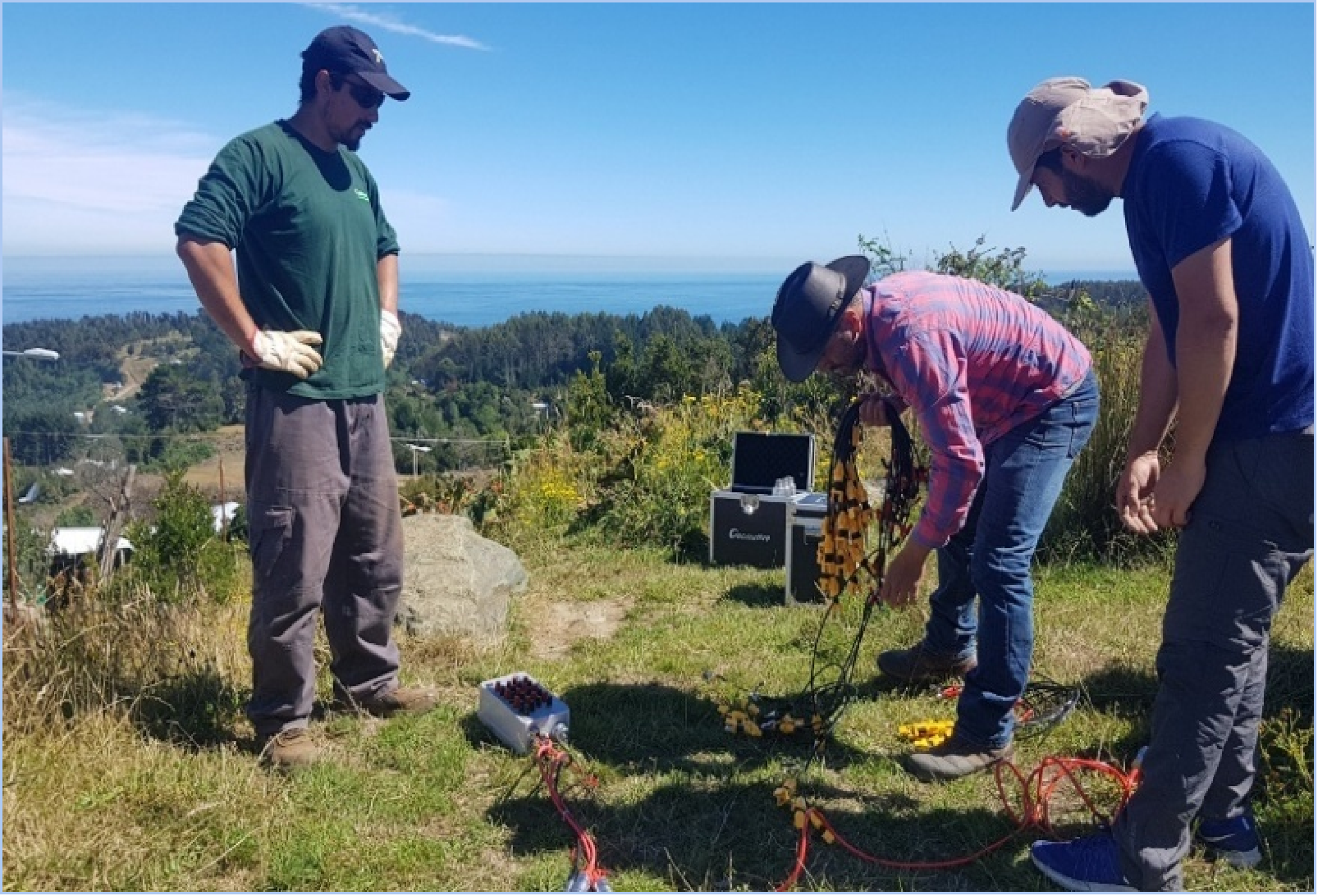
What To Do When Groundwater Exploration Falls Short
Reassess Survey Coverage With Multichannel Electrical Resistivity
For projects requiring broader coverage, Geomative’s GD-20 electrical resistivity system uses an independent 5/12-channel design. In ERT mode, it can support up to 10-channel data acquisition; VES mode can test up to 12 sounding-point sets simultaneously. Under comparable conditions, the product page states that multichannel testing can increase average field efficiency by approximately two to three times compared with single-channel equipment.
The system supports resistivity, induced polarization, self-potential, and relevant 2D, 3D, or pseudo-3D survey configurations. The appropriate configuration should be selected according to the target depth, terrain, electrode layout, noise conditions, and project objective.
Use VES and ERT to Build Candidate Drilling Targets
Geomative’s GD-10 electrical resistivity system supports 1D Vertical Electrical Sounding and 2D ERT/IP profiling. VES can help estimate changes in apparent resistivity with depth, while ERT can provide a continuous resistivity profile along a selected survey line.
These methods can help develop candidate areas for drilling, but a recommended target remains an interpretation requiring confirmation through drilling, borehole logging, water-quality analysis, pumping tests, and local hydrogeological information.
Treat Deep Targets as a Verification Question, Not a Guaranteed Outcome
Deep exploration in hilly terrain requires careful survey design, sufficient electrode spread, appropriate power configuration, and hydrogeological context.
In the Morena district of India, Geomative GD-10 Supreme+ equipment was used for 1D VES and 2D resistivity imaging in a hilly area. The documented conclusion was that no major aquifer system was identified within 150m depth. The local hydrogeological setting suggested that a confined aquifer might exist beyond 150m, but this was not confirmed by the investigation.
This case is useful because it demonstrates an evidence-based outcome: geophysical investigation can reduce the risk of overclaiming a groundwater target when the available data does not support one.
Improve Field Planning and Data Workflow
Before field deployment, Geomative Studio supports survey-array script management and the predefinition of survey parameters on a computer. This can help teams standardize electrode layouts and acquisition settings before fieldwork.
Field data should still undergo quality control and be interpreted alongside topography, geology, existing borehole records, site observations, and independent verification results.
Documented Groundwater Investigation References
Morena, India: Mapping Complex Hilly Terrain
The Morena investigation used GD-10 Supreme+ equipment to study subsurface hydrogeological conditions in hilly sandstone and shale terrain. The resulting 1D VES and 2D ERT interpretation supported a subsurface geological model and identified the absence of a major aquifer within 150m.
The practical lesson is that reliable exploration is not only about finding a positive anomaly. It is also about documenting uncertainty, avoiding unsupported drilling targets, and defining whether deeper investigation or alternative water-supply options should be considered.
Quezon, Philippines: VES-Based Drilling Recommendations
In Barangay Concepcion Banahaw, Sariaya, Quezon, a groundwater investigation included seven VES measurements, hydrogeological assessment, and evaluation of local water-source conditions. The study identified three priority areas for deep-well drilling and proposed recommended drilling depths based on interpreted permeable formations.
The case supports the use of VES as one input to well-siting decisions. It does not establish groundwater yield or water quality before drilling and pumping tests.
Supporting Elements of a Groundwater Investigation Workflow
Field Power Selection
Power requirements should be matched to the survey configuration, target depth, electrode layout, site access, and available energy source. Geomative offers BP-150, BP-300, and BP-450 rechargeable DC power sources, as well as the GP-5000 high-power rectifier for applications requiring external 220V AC input and higher power output.
Power selection supports stable survey operations but does not itself determine investigation depth, data quality, or groundwater yield.
Monitoring Where Long-Term Risk Observation Is Needed
After initial investigation, some projects may require ongoing observation of environmental or infrastructure-related risks. Geomative Online Monitoring System supports online monitoring, inversion, modelling, display, cloud transmission, and configurable warning notifications.
Its stated application directions include landfill leakage, contaminated-site groundwater migration, hydrogeological hazards, tailings/dam safety, and slope-collapse monitoring. Monitoring design should be tailored to the target risk and should be combined with site inspection, sampling, and engineering assessment where required.
A Practical Decision Framework
For organizations reassessing groundwater exploration results, the key question is not simply whether to use a new instrument. A more reliable workflow should consider:
-
the geological and hydrogeological conceptual model;
-
survey coverage, target depth, and electrode configuration;
-
data quality control and interference conditions;
-
resistivity interpretation together with borehole and field evidence;
-
drilling, sampling, water-quality testing, and pumping-test verification;
-
long-term monitoring only where there is a defined operational or environmental need.
Geomative’s GD-10 and GD-20 electrical resistivity systems can provide equipment options for groundwater-related subsurface investigation. Their value lies in supporting more systematic data acquisition and interpretation—not in guaranteeing that every survey site contains a viable water source.
For exploration teams, the most defensible path after an unsuccessful investigation is to use geophysics, hydrogeology, and physical verification together to refine the next decision.
https://www.geomative.com/
Geomative Co., Ltd. -
-
AuthorPosts

- You must be logged in to reply to this topic.